 Origin Energy has signed a multi-year deal that will see Pointerra’s cloud-based digital twin technology used to monitor approximately 750 km of gas transmission pipeline in Queensland — demonstrating how remote sensing and automated analytics can reshape the management of linear infrastructure.
The project was outlined in a blog written by Matthew James, VP of Business Development - Resources at Pointerra, and posted recently to the company’s website.
Pipeline operators have long faced a fundamental challenge: how to efficiently monitor hundreds or thousands of kilometres of geographically dispersed assets while maintaining visibility of changing conditions along the corridor, James noted in the blog.
“Reality capture technologies such as drones and LiDAR are making it possible to capture those environments in increasing detail. But capturing the data is only part of the equation. Turning large, repeated surveys into timely and consistent information that asset managers and engineers can use is where the operational value lies,” he said.
“That is the challenge Pointerra is addressing with its cloud-native digital twin platform, Pointerra3D.”
Pointerra commenced its multi-year programme with Origin Energy in July, which will deploy Pointerra3D as an enterprise pipeline monitoring and analytics solution across approximately 750km of Origin's gas transmission pipeline network.
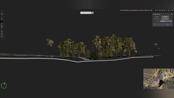
The agreement followed a paid Proof of Concept that demonstrated how drone-acquired LiDAR and imagery could be processed and analysed through Pointerra3D to automate pipeline inspection workflows traditionally reliant on manual review and field-based processes.
Under the programme, Origin's pipeline network will be surveyed quarterly by drone, with Pointerra3D providing the digital environment connecting capture partners with Origin's asset managers and engineers, according to James.
Rather than treating each survey as an isolated dataset, the platform enables successive captures to form part of an evolving digital twin of the pipeline corridor.
This allows teams to identify and quantify changes between surveys and focus attention on areas requiring further investigation.
“Pointerra3D's Pipeline Monitoring Analytics Package provides automated data ingestion and QA/QC alongside analytics including terrain, vegetation and surface change detection; third-party interference detection; erosion volume quantification; depth of cover analysis; vegetation segmentation; encroachment analysis; and automated generation of points of interest,” said James.
“Analytics are targeted for delivery within 24 hours of receipt and validation of drone survey data, giving teams access to actionable information through a secure browser-based environment.”
This approach changes the role of reality capture from simply providing a record of asset condition to supporting repeatable monitoring and decision-making, he added.
“For owners of long linear assets, that distinction is significant. A pipeline corridor can extend across hundreds of kilometres of changing terrain, vegetation and land use. Manually reviewing large volumes of imagery and point cloud data is difficult to scale, particularly when surveys are repeated regularly.
“Automating that analysis allows asset teams to concentrate on identified changes, threats and exceptions rather than manually searching datasets for them.”
For Pointerra CEO and Co-Founder Ian Olson, the move from Proof of Concept into business-as-usual operations is an important demonstration of how automated spatial analytics can be applied to critical infrastructure.
“The Origin Energy contract is a significant milestone for the Company,” said Olson.
“It demonstrates the power of our disciplined PoC-to-BAU engagement model and validates the market demand for automated, cloud-native infrastructure asset monitoring solutions that reduce field exposure, improve compliance outcomes, and deliver actionable insights at scale.”